A List of State Park Campgrounds Near St. Louis
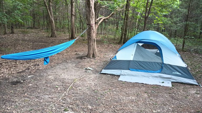
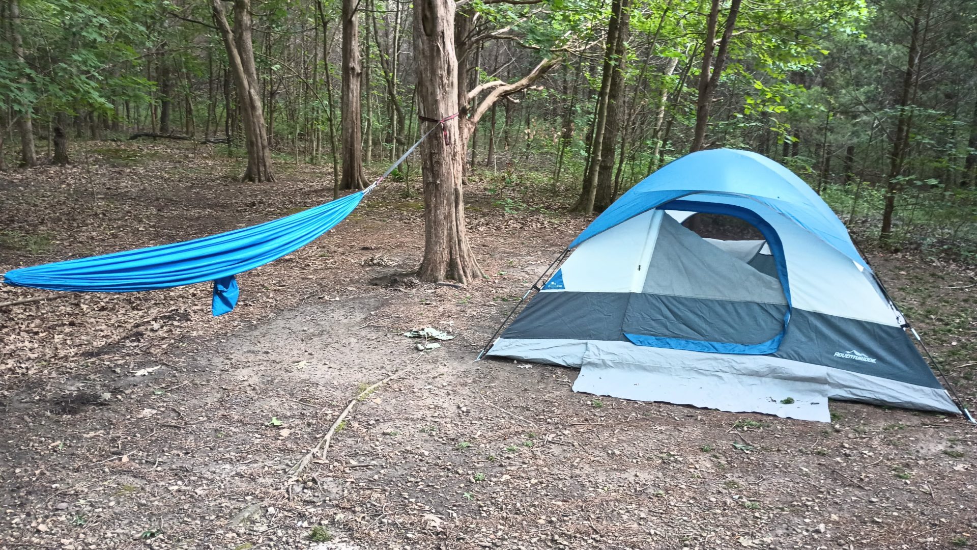
I enjoy tent camping. I also have relatives that own campers. While all of us appreciate the value of camping away from home (my relatives are more adventurous than me on this front), we also all like being able to camp out somewhere close. Not only is it less of a fuss to travel nearby, but if things go south at the campground — and I’ve lived through my share of camping weather calamities — it’s a lot easier just to pack up and go home.
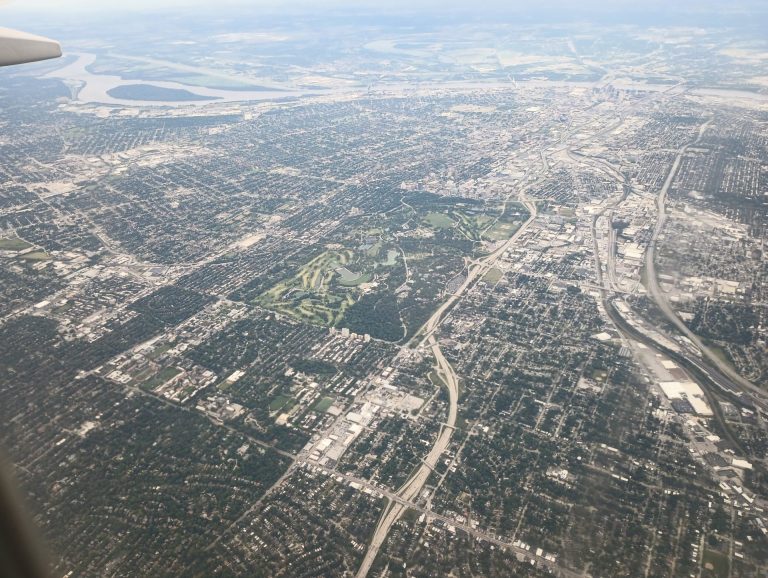
St. Louis is, of course, a major metropolitan area, but it might also surprise some people to know that there are a number of state parks within 1-2 hours of The Lou. Some of them are day use only, meaning you can’t camp there. Castlewood State Park in West County, Route 66 State Park in West County along I-44, Don Robinson State Park in Jefferson County, and Frank Holten State Park in the Metro East are all day use parks.
But other parks have campgrounds, and that’s what I want to talk about here. What follows is a list of state parks that offer campgrounds in or near St. Louis, all of them within a 90-minute drive under normal conditions. Miles and distance are mapped from Forest Park, which is a central location in St. Louis. You may be closer or farther depending on what part of the metro you live in. Of course, traffic, pulling a camper, or other factors could affect that drive time, too.
We’ve either visited or tent camped at several of these state parks. I’ll talk about our experiences when appropriate.
Horseshoe Lake State Park
Distance: 15 miles (about 20 minutes) (Google Maps link)
Site Types: primitive, group
Thoughts: Located in Madison County off of 111 in Illinois, this park has a small campground of 26 sites on a nearly 3,000 acre park. Campsites are not reservable ahead of time other than group sites. Activities include hiking, fishing, boating, and even limited waterfowl hunting. Be aware that this is a truly primitive campground, with no electrical hookups and no showerhouse — just pit toilets.
Website: click here
Dr. Edmund A. Babler Memorial State Park
Distance: 26 miles (about 33 minutes) (Google Maps link)
Site Types: basic, electric, 50 amp electric
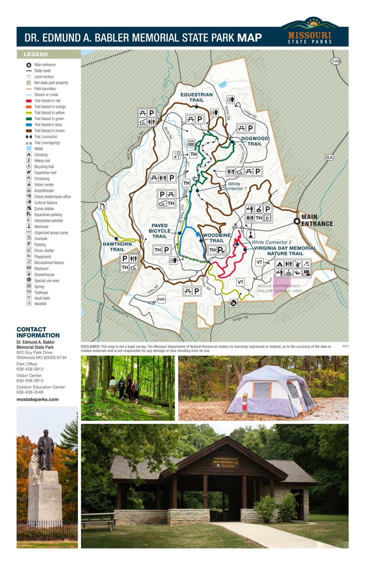
Thoughts: Babler State Park is right in the thick of West County, north of Manchester (MO-100) and west of 109. It’s a full-featured park with a vistor’s center, dozens of campsites, and day use pavilions. It also has a robust system of trails that can fit most tastes: paved, dirt, easy, rugged, hiking, biking, short, long, and even equestrian. We’ve hiked there many times — it’s not our absolute favorite park, but it’s good, and there’s no beating the proximity.
Website: click here
Robertsville State Park
Distance: 40 miles (about 45 minutes) (Google Maps link)
Site Types: basic, electric, family, group
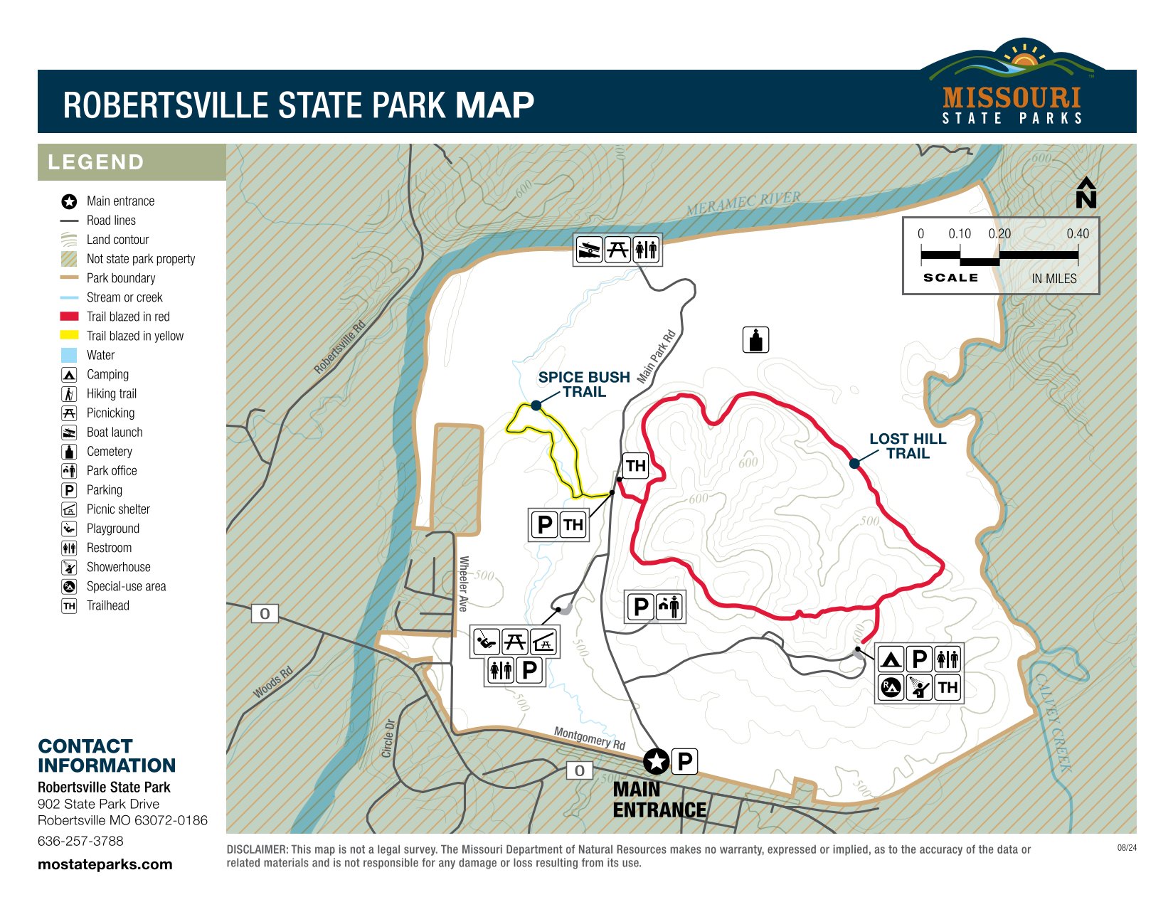
Thoughts: Robertsville is a little gem of a park just down 44 from Six Flags. The single loop is quiet and features both a showerhouse on one side of the loop and a bathroom with toilet and sink on the other side. We’ve camped here multiple times and found it to be peaceful outside of road traffic at night from a nearby rural highway. It’s got a few amenities, including two trails, a boat launch, a grave site for the Roberts family, and a nice day use area. It’s just a stone’s throw from two local attractions, too: Shaw Nature Reserve, operated by the Missouri Botanical Garden, and Purina Farms, which is free and has animal exhibits and shows. Unfortunately, Purina Farms suffered significant tornado damage in March of 2025 and as of mid-2025 is still undergoing restoration efforts.
Website: click here
Pere Marquette State Park
Distance: 42 miles (about 60 minutes) (Google Maps link)
Note: Some travelers, including those in St. Charles, may be able to cut down on the travel time by taking the Grafton Ferry if it happens to be running, but that might be less practical for campers and RVs.
Site Types: primitive, electric (20 / 30 / 50 amp), group
Thoughts: Up the Great River Road from Grafton, Pere Marquette offers a scenic campground overlooking the Illinois River. The park also has a number of amenities, including some lovely trails and a picturesque lodge that houses a restaurant serving food both family style and off of a menu. (We’ve eaten there and it’s terrific.) The campground offers various campsites as well as primitive cabins. You can find guest rooms and more refined cabins over by the lodge.
Website: click here
Cuivre River State Park
Distance: 52 miles (about 51 minutes) (Google Maps link)
Site Types: basic, electric, electric + water, 50 amp electric + water + sewer
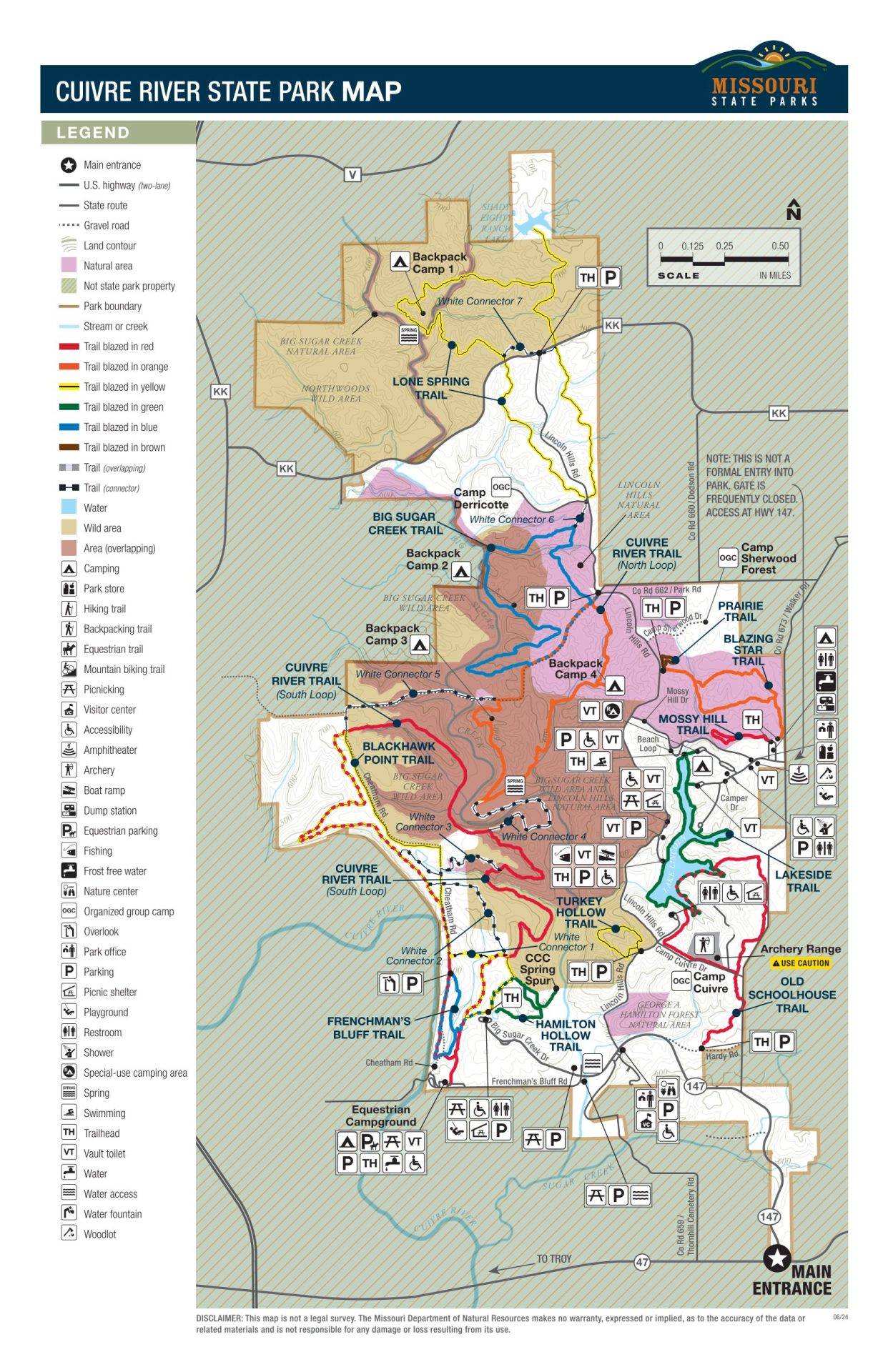
Thoughts: Located near Troy in Lincoln County, Cuivre River is a popular weekend watering hole for STL campers thanks to its full hookups for campers and RVs. There’s also a dedicated equestrian campground for horse owners. Other prominent amenities include several day use areas, trails, and a public beach. We’ve camped there several times and it’s a nice park, although it can get busy, especially on weekends.
Website: click here
Washington State Park
Distance: 54 miles (about 60 minutes) (Google Maps link)
Site Types: basic, electric, family electric, platform tent
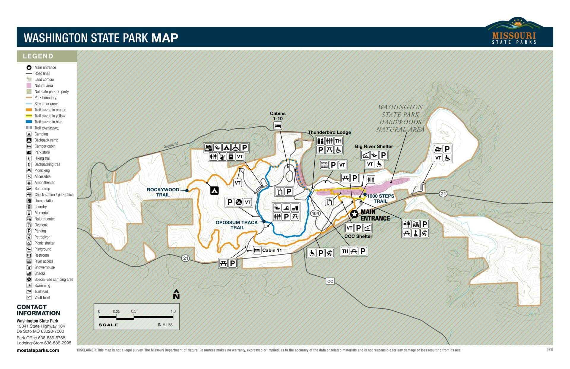
Thoughts: Nestled south of St. Louis, Washington State Park’s perks include trails, a beach along the Big River, and a gift shop at Thunderbird Lodge. It’s also one of two state parks in Missouri where you can see old stone petroglyphs — the other being Thousand Hills State Park up in Northern MO. The campsites, which we’ve stayed in and liked, are spread across two loops, with a showerhouse at each loop. If your party hates tents, Washington also offers cabins we’ve stayed in that are older but clean. And if you’re looking for something to do outside the park, check out the movies playing at the Starlite Drive-In down the road.
Website: click here
Meramec State Park
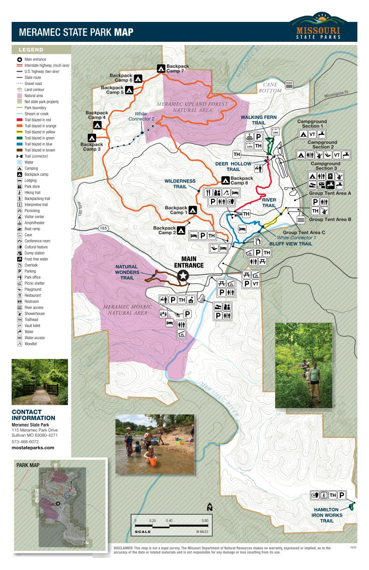
Distance: 64 miles (about 60 minutes) (Google Maps link)
Site Types: basic, electric, 50 amp electric, family, group, backpack
Thoughts: One of the most full-featured parks in the Missouri State Park system, Meramec offers three large campground sections and a designated group area. Trails abound, some of which also offer backpack camping. You can alternatively rent a cabin or motel room. Other activities include cave tours, watercraft (including canoe, kayak, and raft rental), and fishing. A visitor’s center and store + grill round out the experience. Meramec can get quite busy at times — we’ve camped there during some of those times — but there is no shortage of things to do there.
Website: click here
St. Joe State Park
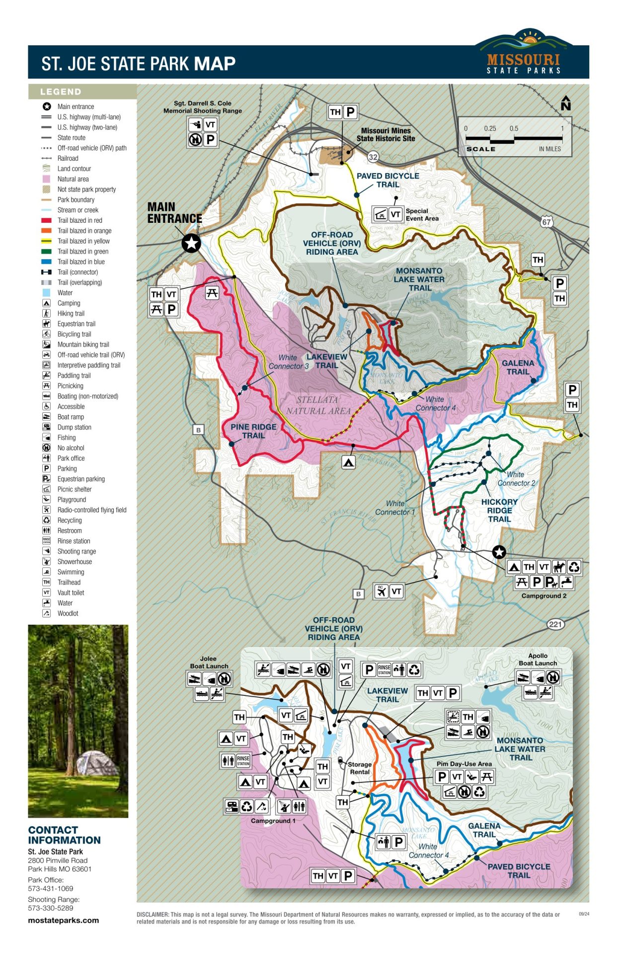
Distance: 71 miles (about 75 minutes) (Google Maps link)
Site Types: basic, electric, 50 amp electric, family 50 amp electric
Thoughts: St. Joe is one of a couple of off-road vehicle parks in Missouri. Be aware that you may hear the roar of engines here. You may also see horses, as equestrian trails are also prominent. There are two campgrounds on property, one of them for off-road vehicle campers and one for equestrian campers. (If you’re a unicorn that does both, talk to park staff.) Other unique amenities include a radio-controlled flying field and a shooting range. You can also find traditional perks like day use areas and hiking trails. We’ve only passed through St. Joe but we found it to be a unique place compared to many other state parks we’ve visited.
Website: click here
Hawn State Park
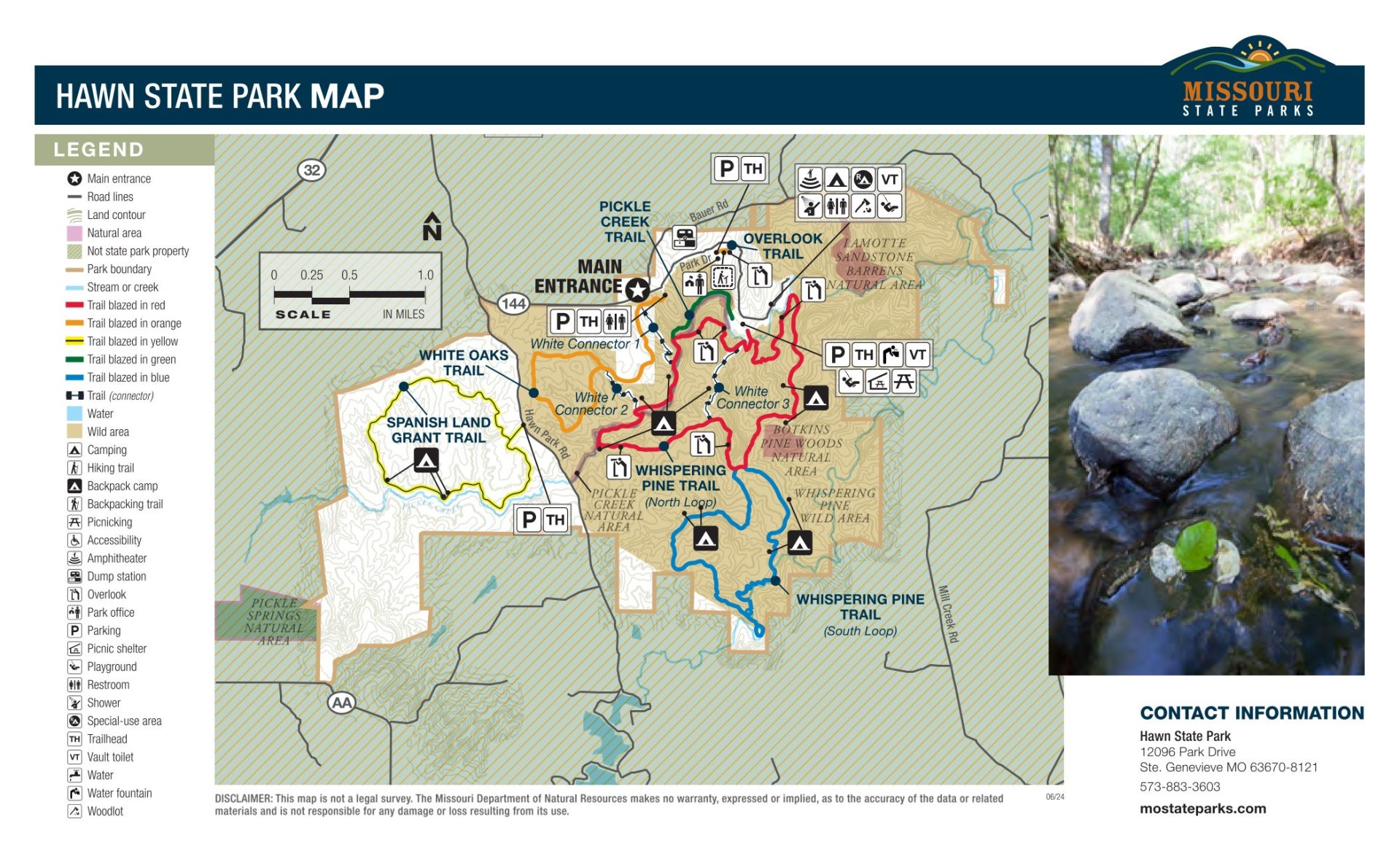
Distance: 73 miles (about 75 minutes) (Google Maps link)
Site Types: basic, electric, 50 amp electric, walk-in, backpack, backpack group
Thoughts: Hawn is a small park known for its scenic river views and dense woods, something we’ve been struck by when we’ve passed through. Five trails crisscross the park, the highlight of the area. Hawn’s big appeal to campers lies in its range of sites, including a walk-in area and more remote backpacking locations for individuals and groups.
Website: click here
Onondaga Cave State Park
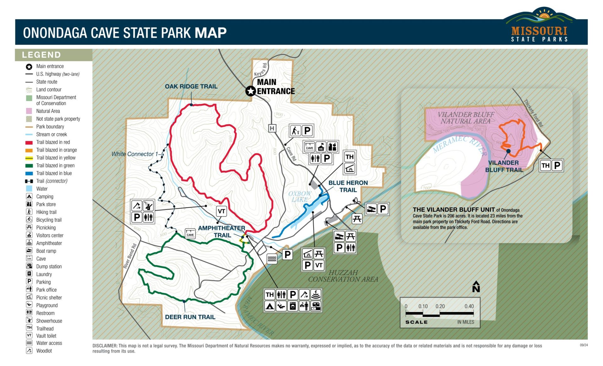
Distance: 79 miles (about 75 minutes) (Google Maps link)
Site Types: basic, 50 amp electric + water, family 50 amp electric + water
Thoughts: The quieter cousin of Meramec, Onondaga is best known for its titular caves, which can be toured for a fee. While not as full-featured as Meramec, you can also hike, fish, and visit the nature center. It’s a more low key and cheaper alternative to the popular-but-touristy Meramec Caverns down the road. We’ve done the cave tours here and liked them.
Website: click here